2D or not 2D?

2D or not 2D ?

2D or not 2D for models in fluvial hydraulics?   This is the question that can agitate modellers when starting their river models. 
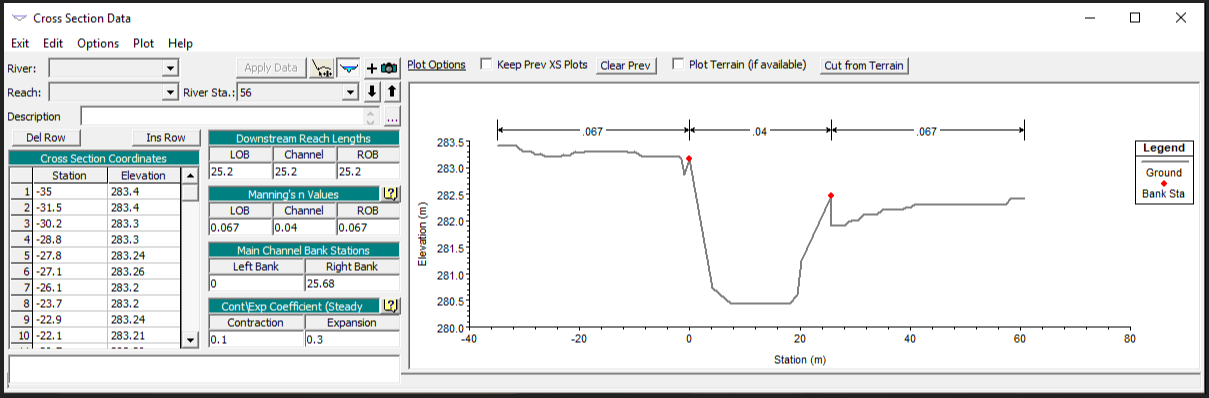
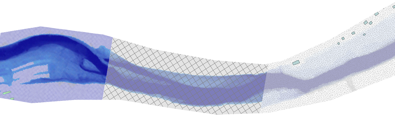
Should we rely on proven, centuries-old 1D methods, even if it means making a few extra gray hairs when stabilizing this damn model, or should we go directly to a complete 2D model, with the risk of seeing the calculation times lengthen? And in this case what to do with this LIDAR which does not cross (in most cases...) the surface of the water ? We try...

HEC RAS cheatsheet

 Action Procédure pan the map "classic" interface   While holding the uppercase key (shift or shift), move the cursor on the map. Measure on the interface "classic" interface   Hold control (ctrl) pressed while drawing the desired measurement (allows you to measure distances, slopes, draw profiles on the DTM) Extend cross sections under HEC RAS "classic" interface   In the GIS tools of the classic...

Import 3D cross sections from QGIS to HEC RAS

In the HEC RAS ​​training courses that I run, the question of optimizing the building of the models comes out regularly. In this post, I detail a way to import profiles across streams available in the form of 3D polylines in HEC RAS ​​to speed up this build process. The detailed approach here is certainly not the only solution, nor necessarily the optimal approach, but it is based on free and easily accessible tools. Goal : Generate HEC RAS ​​.csv file for importing cross sections from 3D...

2D modelling roundup with HEC RAS, Tuflow and ICM

The studies on which I intervene regularly lead me to use different software for 2D modeling in river and urban hydraulics. There are a number of reasons why one software can be chosen over another: History, first: when it comes to re-exploiting existing models, it makes more sense to use the same software, in order to avoid, among other things, having to rebuild, recalibrate and completely revalidate the model. Expected performance, then: some contexts require mobilizing software that has...

From real time modelling to crisis management

I have already written here two articles dealing with the experimental flood forecasting pilot set up in partnership with GEOMOD around the solution ICM Live (sorry, only available en French for now) : Real-time modeling: the article briefly describes the operation of an automated modeling system Cascading simulations: this article presents the principle of simulations triggered at the detection of certain events in data flows or in a simplified global simulation We will address here in...