ICM - correct mesh errors
This post is part of a series of articles about modeling coupled 1D / 2D river and urban water and models optimizations
2D modeling are consuming resources and computing time, it is therefore essential to work with own grids, and optimize them.
This requires the following checks:
- avoid computational elements uselessely too small, ie which do not provide relevant information for the purpose of the study. This point is important, it is in fact the size of the smallest element of calculation in water throughout the whole mesh (even if only one of these little elements) which determine the calculation time step via the Current Number, this is especially important if the flow velocities are important. These small elements can form on areas where the mesh forcing elements meet and are badly hung (limits of reaches, forcing lines, bank lines etc ...).
- avoid water elements at the beginning of simulation, including calculations of elements at the points of connection 1D / 2D (from riverbanks, sewerage manholes connected to the 2D area), which are not supposed to be flooded early in the simulation. We are not talking here of mesh elements that would water voluntarily beginning of the simulation (estuarine waters rooms, stream sections in 2D).
To detect these elements, simply to appeal to the themes of geoplan :
I - To detect small computational elements in ICM:
Go to the themes, create a new theme for 2D area, based on the field "mesh element area"
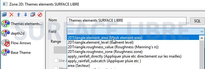
Set a theme to correctly identify the surface elements below a threshold you choose, here 1 m².
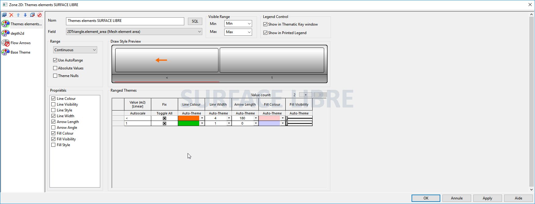
The result will be immediately visible on the mesh:
You can then spot the errors, correct the non snapped lines or polygons and remesh.
PS : it can be usefull to save the theme in order to use it as a check after each remesh.
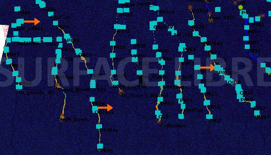
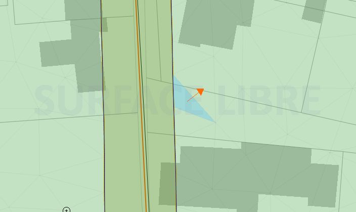
II - To identify the elements flooded too early in simulations, and that should not be:
In the case of river 1D/2D coupling, it is always necessary to thoroughly check the profile along the banks before launching the first simulations, it can indeed happen that it found low points, which will disrupt the model by draining the reaches directly into the 2D area from the beginning of the simulation. However, sometimes some mistakes slip through the net, leading to flooded elements at the beginning of the simulation. These are often difficult to identify visually, especially for large models, because it is often small-sized elements located along the reaches.
A simple theme based on filling the mesh only rarely allows to easily spot these elements, however we can apply the same approach as described above, and add arrows to identify those flooded mesh elements. (Note: This verification can be done after having rotated a first simulation).
Finally, it is also possible to find the identifier of these water elements from the start by monitoring Job Progress, the identifiers of flooded elements is displayed in the lower sections.
Did you enjoy this article ? Feel free to share and follow us on Twitter @Surfacelibre. Need customized training on 1D / 2D modeling in river hydraulics, optimization and shaping computational meshes, or debug of complex models? Feel free to also contact us.